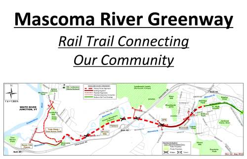
Summer work should allow cyclists, runners and walkers to make use of the 4-mile path that will connect downtown and West Lebanon, said Frank Gould, who is co-chairman of the volunteer group working on the greenway. But the results of a downtown visioning survey could mean the path shares the roads downtown rather than going through a discontinued rail tunnel.
“I personally believe it is not a safe thing to do in the downtown area,” Gould said of possible road-sharing plans. “I think most of my committee agrees with that.”
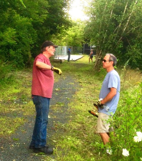
Gould has been working on the greenway’s construction since leaving the state Legislature about four years ago. The idea’s been kicked around for decades, he said, but it wasn’t until the state offered use of an east-west railroad bed that work could begin.
Working alongside the city’s recreation and parks department, volunteers held workdays along the trail and raised more than $2.3 million for construction and paving.
Gould said their mission is to allow for easier movement between downtown and West Lebanon without having to worry about traffic or main roads. When Lebanon first became a city more than 50 years ago, he said, pedestrians didn’t have any easy options to go between the two neighborhoods, and that’s a challenge the city is still facing today.
“It’s going to tie our community from east to west,” Gould said.
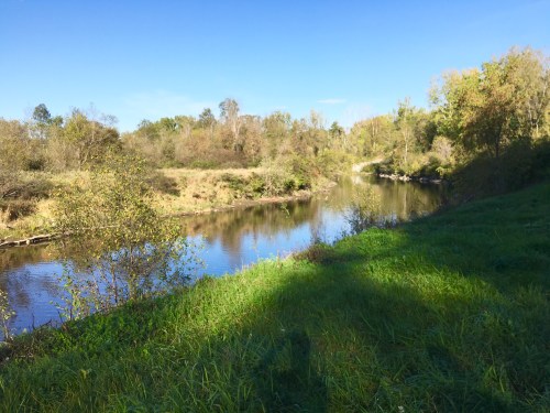
Regardless of what the city decides for downtown, the proposed trail will begin where the Northern Rail Trail ends at Spencer Street. From there, it will follow the railroad bed, cross the Mascoma River several times and will come to an end near Seminary Hill. Paving is slated to begin next year, and the city has committed to plowing one side and will set cross-country ski tracks on the other.
But proposals for Lebanon’s downtown could hamper the greenway’s goal of being a separate space for pedestrians and cyclists. Of three alternative plans, only one allows for use of the rail tunnel.
Lebanon’s visioning study was introduced partially because, in 2014, the tunnel was dilapidated and in need of repairs. A city-owned parking lot above the tunnel was closed that fall and the city signed a contract for more than $300,000 with Massachusetts-based consulting firm Vanasse Hangen Brustlin to seek input about the future of downtown.
Working hand-in-hand, consultants and officials hosted a series of community discussions and released an online survey. More than 800 comments were gathered, which allowed the consultants to create three alternatives for downtown.
All three were shown to the public during a February meeting, according to Lebanon Planning and Zoning Director David Brooks. But even with all of the comments, the city still doesn’t feel that there’s a preferred option that most people feel comfortable with, he said.
Brooks said the city put consultants in a “holding pattern” and are asking people to participate in a second survey. He’s also making presentations and giving updates to city boards and businesses.
Gould is hoping that residents will respond to the survey and choose to keep the rail tunnel.
“The tunnel is paramount for safe transit through downtown Lebanon,” he said.
People can find the survey on the city’s website at planning.lebnh.net. Brooks is also scheduled to speak about visioning at 6:30 p.m. tonight at the Planning Board meeting in the City Hall Council Chambers.
Volunteers with the Mascoma River Greenway will also be presenting final construction plans from 5:30 to 7 p.m on April 7 in the City Hall Council Chambers.
Tim Camerato can be reached at tcamerato@vnews.com or 603-727-3223.


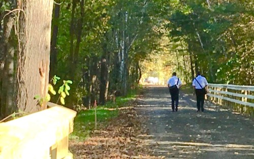


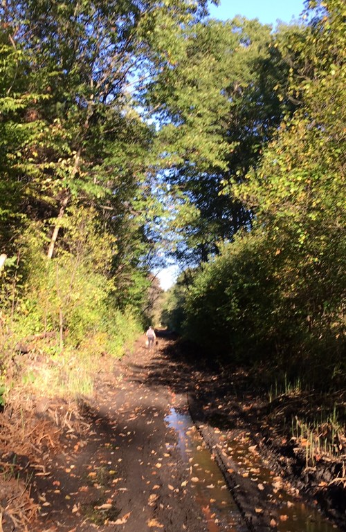


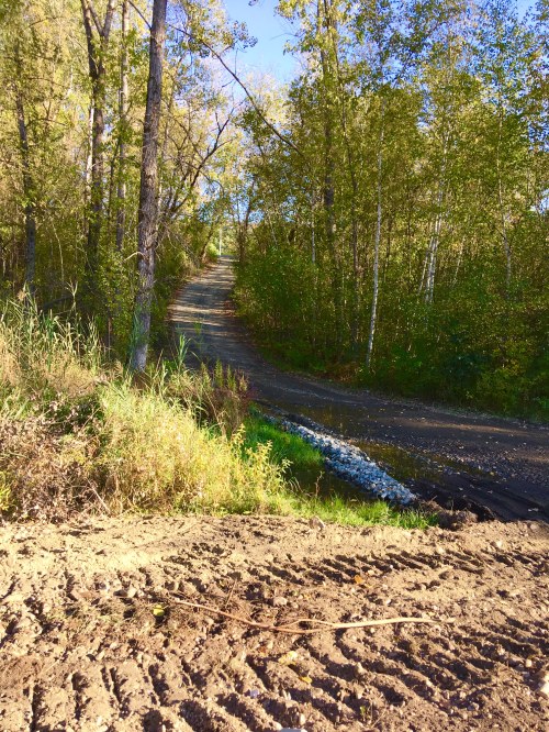

 Walking to the overpass near APD, the trail was wide and nicely graded.
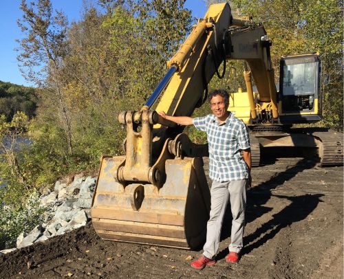
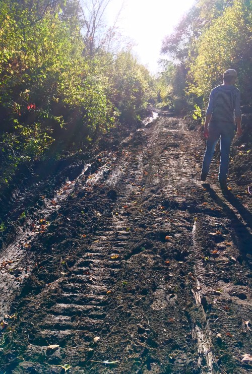
 Heavy equipment to accomplish the job
 A tangle of vines in the trees.
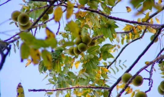


 Through the trees, we could see Jake’s on Mechanic Street, a destination for some of the walkers we encountered on the trail. Proximity to Mechanic Street made us realize that, on weekdays, walkers could walk one way on the trail and then hop an Advance Transit bus for the return trip.
 A number of homes on Mascoma Street have easy access to the trail.

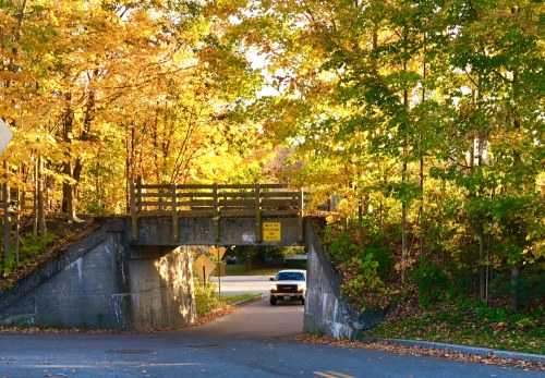
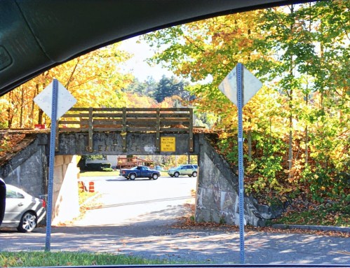
 This is the MRG as it crosses the overpass by APD (you can see a car on the right heading under the bridge.) Tracks and rails have been removed. A safety rail will be installed here.
 Heading west, a safety rail is partially installed by a small pond. Rails and tracks are gone and the trail has been widened and graded.
 The approach to the I-89 bridge
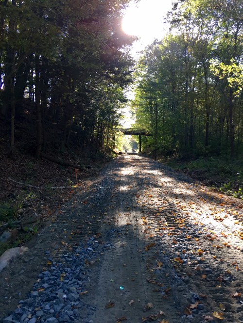
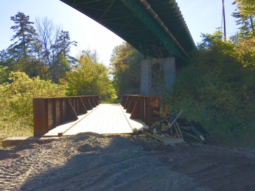
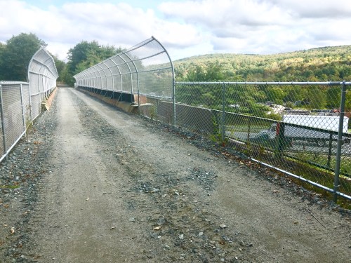 I-89 bridge
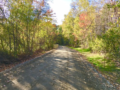
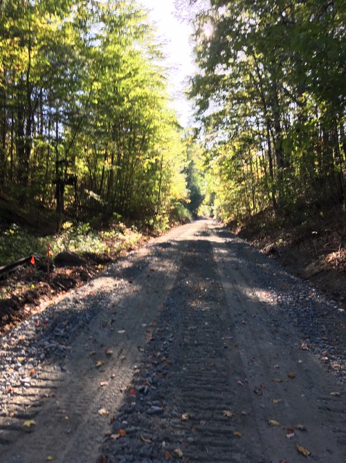
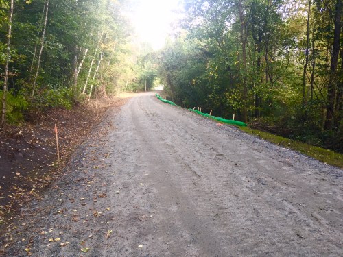 Much of the trail is now broad and graded like this.
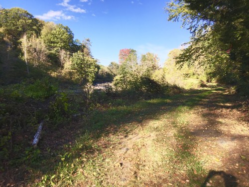
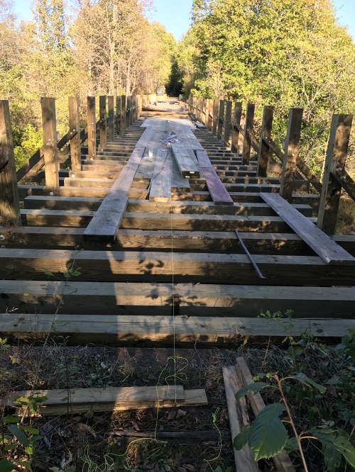
 This is the bridge over the Mascoma River. It is currently in poor repair and blocked, and therefore, the end of our westward walk. Lots of work needed here! Progress has been made at the far end of this bridge, and we will report on that progress soon.
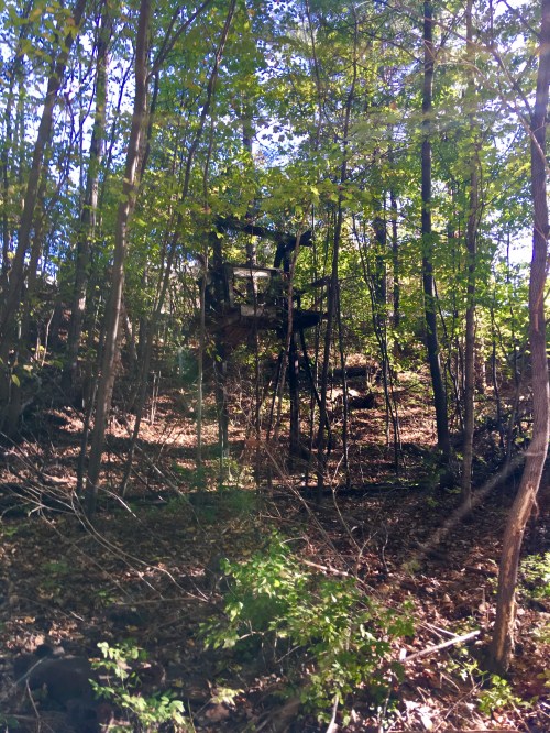
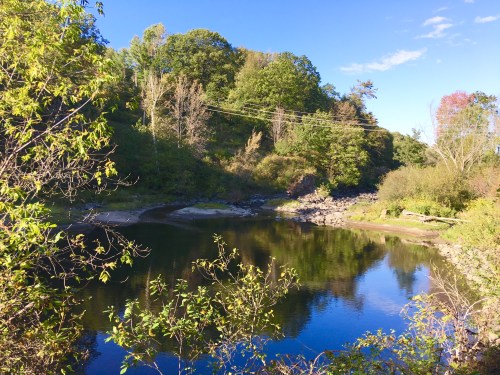
 Looking east from the blocked Mascoma River bridge notice the post hole digger. Such a major project!
 Heading back east, we encountered these mountain bikers who have already discovered the enjoyment of the improved trail! (We also saw a number of walkers – commuting to Renihan Meadows?)
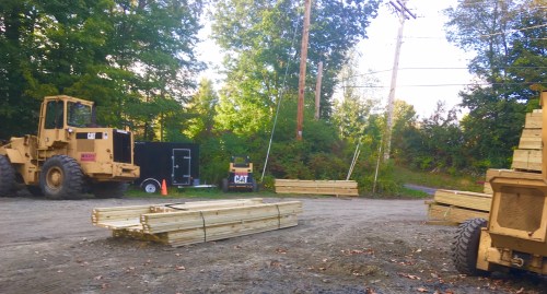
 By Tim Camerato