Kiosk at intersection of Mascoma, High, and Mechanic streets
Today was hot and humid; we welcomed the shade and dappled light at the entrance to the trail at the junction of Mascoma, Mechanic and High streets.
 Walking to the overpass near APD, the trail was wide and nicely graded.
 Heavy equipment to accomplish the job
 A tangle of vines in the trees.
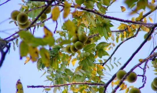
Walnuts on the ground alerted us to a black walnut tree with nuts high above .
We were attracted to the bright red berries of the Woody Nightshade (Solanum dulcmara) along the trail. The berries are toxic.

It is also called Climbing Nightshade, appropriate, given how high the plant had climbed.

Woody Nightshade /Climbing Nightshade
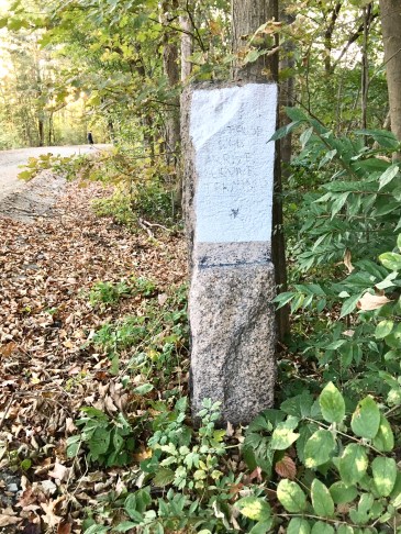
Mile Marker 139
Erected before the Civil War by the new Northern Railroad to mark distances from Concord to White River Jct., the mile markers along the rails were relocated when the line was absorbed by the Boston & Maine in 1887. The posts then ticked off the 143 miles from Mile 0.00 at B – North Station, Boston – to the terminus at WRJ – Mile 142.92 in VT. (Thanks to the Northern Rail Trail site for this information.)
 Through the trees, we could see Jake’s on Mechanic Street, a destination for some of the walkers we encountered on the trail. Proximity to Mechanic Street made us realize that, on weekdays, walkers could walk one way on the trail and then hop an Advance Transit bus for the return trip.
To locate an Advance Transit bus stop:
1. Go to Google Transit by clicking on the link below.
2. Drag the map to display the general area you are interested in, or enter a starting and ending point in the “Directions” box.
3. Zoom in on the map until bus stop symbols appear.
4. Click on a bus stop symbol to see the name of the stop and the names of the bus routes that serve this location.
5. Click on the “Street View” picture to get a look at the stop. You may need to click and drag the picture to bring the bus stop sign into view.
GO TO GOOGLE TRANSIT NOW
And remember Advance Transit buses can carry bikes.
 A number of homes on Mascoma Street have easy access to the trail.

We encountered several walkers and bikers on the trail. Near our destination, the overpass by APD, we met a woman with her dog “Willow”; they are frequent walkers here. She used to walk the tracks all the way to West Lebanon and is very eager for the bridge over the Mascoma River to be repaired, and for the MRG to be completed. Aren’t we all?! It is exciting to see we are well on our way.
Looking east toward our starting point, happy with the progress on this lovely trail.

Looking eastward toward the intersection of Mechanic, Mascoma, and High streets