 For those of us without a tool to measure mileage on the MRG, here is an estimate of the mileage between points.
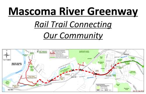
DudleyBridge<.36 >PriceChop<.75>MascomaBridge<.28 >1-89Bridge<.48 miles> SlaytonHill<.6 miles>Kiosk
If you start at the Price Chopper parking lot access on the Miracle Mile (RT. 4/Mechanic St.) and go left (West), it is .36 mile to the Dudley Bridge. If you loop back by way of the path along the river, you will have traveled a .76 mile loop back to the parking lot access road.
If you start at the Price Chopper access road and go right (East), it is .75 mile to the middle of the bridge over the Mascoma River (near Timken.)
Continuing eastward it is .28 mile to the middle of the bridge over Interstate 89.
Then .48 mile from the middle of the Interstate bridge to the middle of the Slayton Hill Overpass by Alice Peck Day Hospital.
It is then .6 mile to the kiosk at the intersection of Mascoma, Mechanic and High Streets.
At some point we will have a map of the MRG drawn to scale . . . but in the meantime, we have these estimates.
(Thanks to Paul Coats and Rainie Kelly for these estimates.)